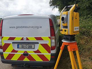
At GeoData Surveying Ltd, our experienced teams of Chartered Surveyors deliver high quality and detailed Topographical Surveys to clients & RICS-specification throughout Ireland and the UK.
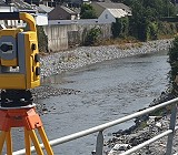
Our skilled surveying crews use the latest GPS, reflector less and robotic total stations along with high precision digital levels and terrestrial Laser Scanning to provide our clients with an expert and reliable solution to capture 3D data.
High definition Laser Scanning, allows us to capture huge data sets remotely minimising traffic management and road closures on road and junctions surveys.
Data can be delivered to support AutoCAD 2D & 3D plan drawings, MX Genio along with a 3D surface model to support Building information Model (BIM) & Revit Surface Model.