Limerick City has been designated as one of three centres in Ireland that are to become Ireland’s First Smarter Travel Demonstration Areas.
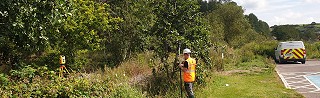
As part of this initiative GeoData Surveying was selected to carry out a Topographical Survey of a corridor of land 4km in length with an average width of 10m.
The Survey was to enable the design of a 4m wide shared walking and cycling facility that will link the University of Limerick with the City Centre along the banks of the River Shannon and the Canal. The project also included the survey of 5.no bridge historic structures to be incorporated into 3D ground model of the corridor. Feel free to get in touch with us today to find out more information.